
Purandar Airport Map
The PMRDA GIS Portal provides a visual representation of the planned Chhatrapati Sambhajiraje International Airport area in Purandar. Here’s why this map matters for investors and land buyers.
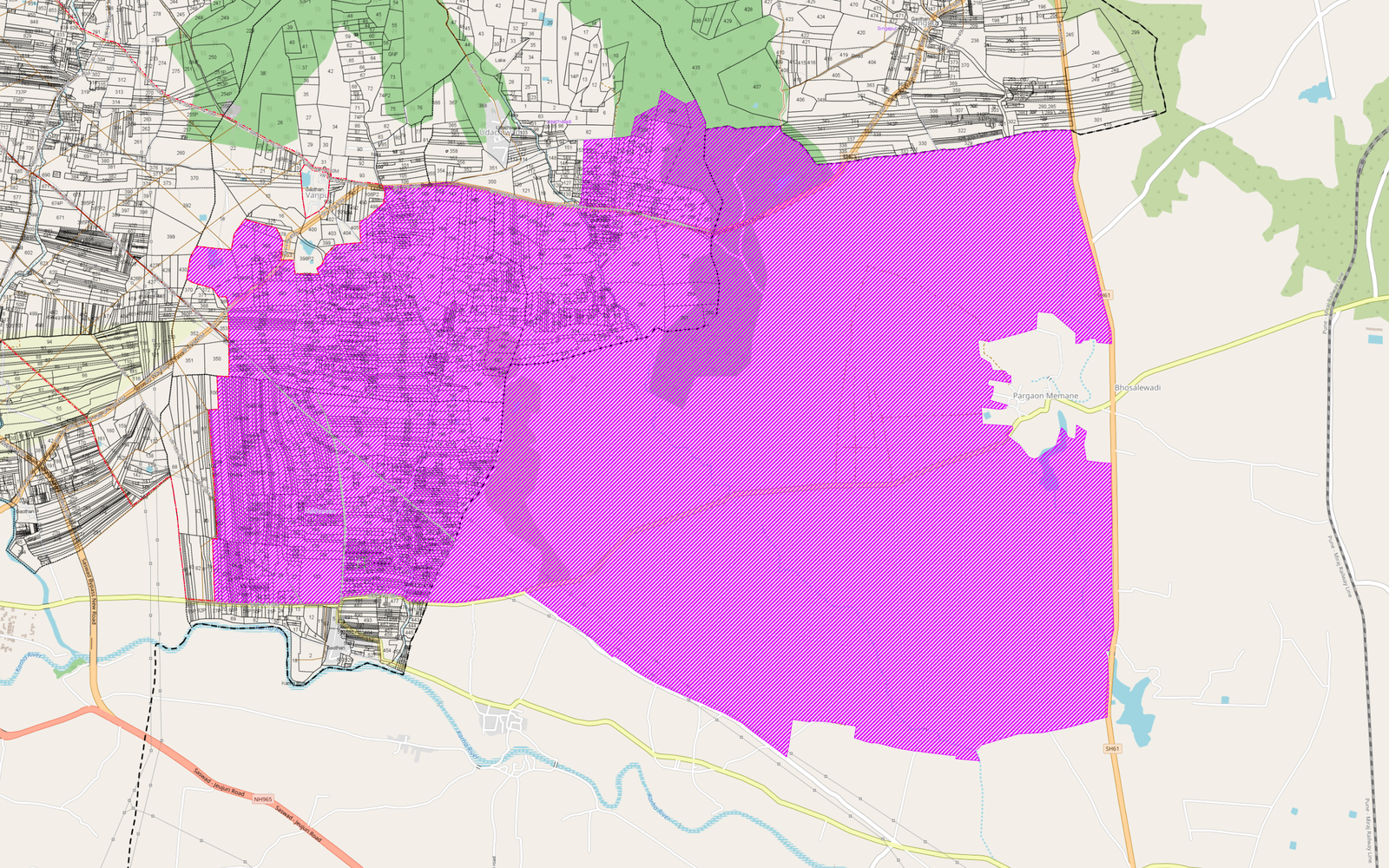
The image above is sourced from the PMRDA GIS Portal and shows the planned area earmarked for the Chhatrapati Sambhajiraje International Airport, Purandar.
The highlighted (purple) region represents the airport planning zone within the PMRDA jurisdiction. While the map itself does not indicate construction timelines or land acquisition status, it offers valuable insight into the scale and location of the proposed airport.
Why This Map Matters
For anyone tracking infrastructure-led growth in the Purandar region, official planning maps provide an important reference point.
They help investors understand:
- The approximate airport planning area
- Nearby villages and road connectivity
- Surrounding development potential
- The overall footprint of the proposed project
Infrastructure Creates Opportunity
Large infrastructure projects often encourage additional development over time, including:
- Road network upgrades
- Logistics and warehousing
- Commercial activity
- Residential demand
- Supporting public infrastructure
As these projects progress, nearby areas may experience increased interest from businesses and investors.
A Useful Planning Tool
The PMRDA GIS Portal is a valuable resource for visualizing planned infrastructure and understanding how different villages relate to the proposed airport location.
While investment decisions should always include legal due diligence and verification of land records, official planning maps can help buyers better understand the broader development landscape.
---
Image Source: PMRDA GIS Portal
This article is intended for informational purposes only. Planning maps may be updated by the relevant authorities, and investors should verify the latest official information before making any investment decisions.
Want land in this zone?
Browse curated, clear-title plots across the Purandar corridor.
Explore Land ProjectsRelated insights
 Infrastructure
PMRDA Town Planning Scheme
If your land comes under a PMRDA Town Planning Scheme, you may not retain the same plot area, shape or location. Understand Original Plot, Final Plot, land deduction and development potential before investing.
Read insight Infrastructure
Purandar IT Park
An official MIDC communication proposes the transfer of over 572 hectares of government grazing land across four villages in Purandar Taluka for the development of a proposed IT Park.
Read insight Infrastructure
Pune Outer Ring Road
The proposed Ring Road around Purandar isn’t just about reducing travel time—it’s expected to improve connectivity, unlock development, and create new investment opportunities across the region.
Read insight